Abstract
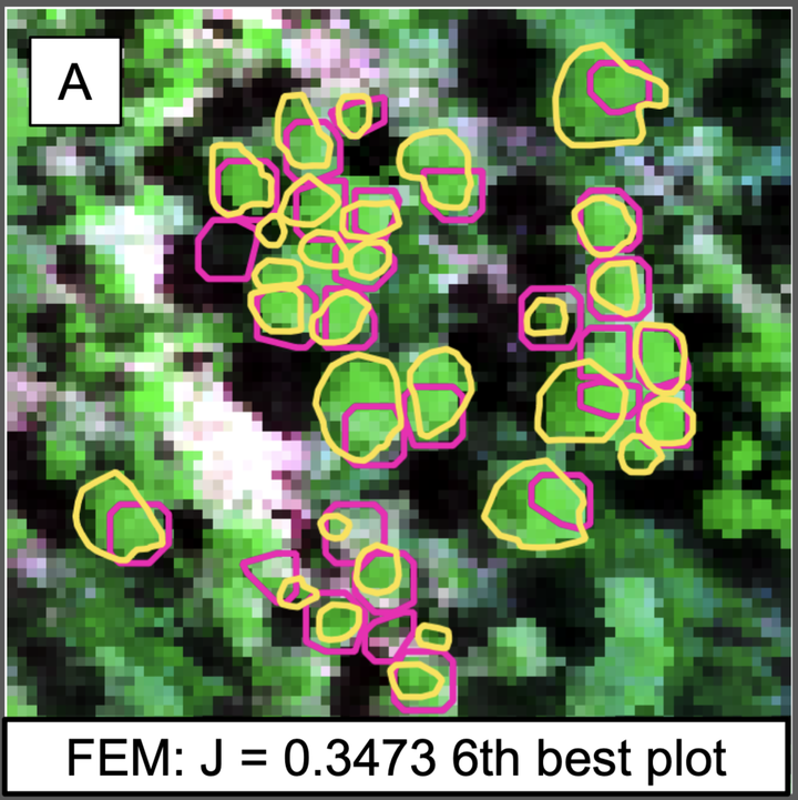
Ecology has reached the point where data science competitions, in which multiple groups solve the same problem using the same data by different methods, will be productive for advancing quantitative methods for tasks such as species identification from remote sensing images. We ran a competition to help improve three tasks that are central to converting images into information on individual trees:(1) crown segmentation, for identifying the location and size of individual trees;(2) alignment, to match ground truthed trees with remote sensing; and (3) species classification of individual trees. Six teams (composed of 16 individual participants) submitted predictions for one or more tasks. The crown segmentation task proved to be the most challenging, with the highest-performing algorithm yielding only 34% overlap between remotely sensed crowns and the ground truthed trees. However, most algorithms performed better on large trees. For the alignment task, an algorithm based on minimizing the difference, in terms of both position and tree size, between ground truthed and remotely sensed crowns yielded a perfect alignment. In hindsight, this task was over simplified by only including targeted trees instead of all possible remotely sensed crowns. Several algorithms performed well for species classification, with the highest-performing algorithm correctly classifying 92% of individuals and performing well on both common and rare species. Comparisons of results across algorithms provided a number of insights for improving the overall accuracy in extracting ecological information from remote sensing.
Supplementary notes can be added here, including code and math.